Warning: Javascript must be enabled to use all the features on this page!


Page Loading - Please Wait...

Click to hideNews Bulletins
  • Due to a lapse in government funding, the majority of USGS websites will not be updated except to provide important public safety information. Websites displaying real-time water data will be updated with limited support. For more information please see www.doi.gov/shutdown.
  • Explore the NEW USGS National Water Dashboard interactive map to access real-time water data from over 13,500 stations nationwide.
! This page is undergoing modernization with expected decommissioning as key features are added to the modernized pages.
Learn more about our modernization plans to find out which options will suit you best. Next Generation Monitoring Location Page is available now.
A beta version of the My Favorites page is available in WDFN. Try it out and tell us what you think at wdfn@usgs.gov

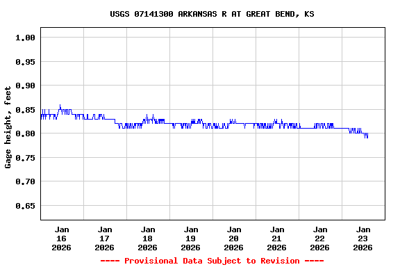
USGS 07141300 ARKANSAS R AT GREAT BEND, KS

PROVISIONAL DATA SUBJECT TO REVISION

Click to hidestation-specific text

This station is operated by the USGS and funded by the Logo for COE U.S. Army Corps of Engineers, Tulsa District, Logo for KWO Kansas Water Office, and the Logo for USGS USGS.

Logo for NWS The National Weather Service flood stage for this site is 12.0 ft. (Forecast)

Logo for rating Current shift-adjusted rating in tab-separated format. What is a shift-adjusted rating?

Logo for email Logo for SMS Subscribe to USGS WaterAlert to receive push notifications when specific conditions occur at this site.
Station is being affected by beaver activity. Discharge values should be used with caution.


Minimum Desirable Streamflow (MDS) in cfs
Jan Feb Mar Apr May June July Aug Sept Oct Nov Dec
3 3 3 3 10 10 5 3 2 2 2 3
This station managed by the Hays field office.

Available Parameters Available Period


 (7)
 

  -- or --


Summary of all available data for this site
Instantaneous-data availability statement