Warning: Javascript must be enabled to use all the features on this page!
Page Loading - Please Wait...
Click to hideNews Bulletins
Explore the NEWUSGS National Water Dashboard interactive map to access real-time water data from over 13,500 stations nationwide.
This page is undergoing modernization with expected decommissioning as key features
are added to the modernized pages.
Learn more about our
modernization plans to find out which options will suit you best. Next Generation Monitoring Location Page
is available now.
A beta version of the My Favorites page is available in WDFN.
Try it out and tell us what you think at wdfn@usgs.gov
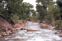
USGS 09405500 NORTH FORK VIRGIN RIVER NEAR SPRINGDALE, UT
Station operated by the U.S. Geological Survey,
with Cooperative Matching Funds with the Utah Department of Natural
Resources, Division of Water Rights.
The 15-minute precipitation data for this station
are temporary and will only be displayed for 120
days. Time series of 15-minute or cumulative daily values
will NOT be available for retrieval following the 120-day
display period. Although the instrumentation is calibrated at
least once per year, the temporary classification means that
documented routine inspections and other quality assurance
measures are not performed that would make the data
acceptable for archival, retrieval, or future use in general
scientific or interpretive studies.
This station managed by the Cedar City UT Field Office.