Funding for this site is provided by:
 STATION.
--01550500 LYCOMING CREEK NEAR WILLIAMSPORT,
PA
LOCATION.--Lat 41`16'01", long
77`02'49", Lycoming County, Hydrologic Unit 02050206, 150 ft
downstream from concrete bridge on U.S. Highway 15, 1.2 mi downstream
from Beauty's Run, and 3.4 mi upstream from mouth.
DRAINAGE AREA.--268 square miles.
PERIOD OF RECORD.--1908-1913, (continuous-record site
operated by the Pennsylvania Department of Forest and Waters. Published
as "at Bridge No. 2, near Williamsport). 1982-1987, (low-flow
partial-record station). 1988-1990, 1995-2018, (continuous
record-annual peak site). October 1, 2018 to current year, operated as
a stage-only site.
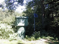
GAGE.--Water-stage recorder. Datum of gage is 530.12
ft above North American Vertical Datum of 1988. Satellite telemetry at
station.
COOPERATION.--Station established and maintained by
the U.S. Geological Survey in cooperation with the Pennsylvania
Department of Environmental Protection.
REMARKS.--Daily discharge not available. The
streamgage cannot record stream levels below a stage of 1.56
feet.
GAGE HEIGHTS OF IMPORTANCE.-
Supplied by USGS: Maximum recordable gage height
(stage sensor operational limit) - 19.0 ft; Data transmitter
operational limit - 20.4 ft;
Supplied by NWS: No flood stage has been determined
for this station.

