Funding for this site is provided by:
 THIS SITE DOES NOT USE SATELLITE
TELEMETRY AND THEREFORE THE DATA WILL ONLY BE UPDATED ABOUT EVERY 8
WEEKS.
THIS SITE DOES NOT USE SATELLITE
TELEMETRY AND THEREFORE THE DATA WILL ONLY BE UPDATED ABOUT EVERY 8
WEEKS.
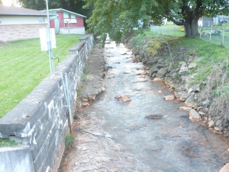
STATION.--03040050 TROUT RUN AT PORTAGE, PA
LOCATION.--Lat 40`23'08", long
78`40'33", referenced to North American Datum of 1983, Cambria
County, PA Hydrologic Unit 05010007, on right bank 30 ft upstream from
Jefferson Avenue bridge.
DRAINAGE AREA.--6.44 square miles
PERIOD OF RECORD.--June 2009 to current year
GAGE.--Water-stage recorder and crest-stage gage.
Datum of gage is 1680 ft above National Geodetic Vertical Datum of
1929, from topographic map.
COOPERATION.--Station re-established and maintained by
the U.S. Geological Survey in cooperation with the U.S. Army Corps of
Engineers, Pittsburgh District.
REMARKS.--Gage is operated as a stage-only site for
the U.S. Army Corps of Engineers (Pittsburgh District) Local Flood
Protection Project (LPP).
