Warning: Javascript must be enabled to use all the features on this page!


Page Loading - Please Wait...

Click to hideNews Bulletins
! This page is undergoing modernization with expected decommissioning as key features are added to the modernized pages.
Learn more about our modernization plans to find out which options will suit you best. Next Generation Monitoring Location Page is available now.
A beta version of the My Favorites page is available in WDFN. Try it out and tell us what you think at wdfn@usgs.gov

USGS 07182510 NEOSHO R AT BURLINGTON, KS

PROVISIONAL DATA SUBJECT TO REVISION

Click to hidestation-specific text

This station is operated by the USGS and funded by the Logo for COE U.S. Army Corps of Engineers, Tulsa District and the Logo for USGS Federal Priority Streamgages. Water-quality monitors funded in cooperation with Logo for KWO Kansas Water Office, Logo for KDHE Kansas Department of Health and Environment and USGS matching funds as part of the USGS National Water Quality Program.

Logo for NWS The National Weather Service flood stage for this site is 27.0 ft. (Forecast)

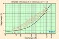
Logo for rating Current shift-adjusted rating in tab-separated format. What is a shift-adjusted rating?

Logo for email Logo for SMS Subscribe to USGS WaterAlert to receive push notifications when specific conditions occur at this site.

Logo for USGS Real-time Water Quality Visit USGS Real-Time Water Quality to view continuous estimates of concentrations and loads for bacteria and other chemicals.


This station managed by the Lawrence field office.

Available Parameters Available Period
  
2007-10-01  2015-10-21
2015-10-23  2026-10-15
1990-10-01  2026-10-15
2007-10-01  2026-10-15
2007-10-01  2015-10-21
2015-10-23  2026-10-15
2007-10-01  2015-10-16
2015-10-23  2026-10-15


 (7)
 

  -- or --


Summary of all available data for this site
Instantaneous-data availability statement

Most recent instantaneous value: 22.2 10-15-2026   00:45 CDT
Graph of  Temperature, water, degrees Celsius

Add up to 2 more sites and replot for "Temperature, water, degrees Celsius"

?


Create presentation-quality / stand-alone graph.   Subscribe to WaterAlert      

See this graph on the Monitoring Location Pages


Temperature, water, degrees Celsius, Discontinued Oct. 22, 2015, [Discontinued Oct. 22, 2015]
 
-- Data temporarily unavailable for the time period specified --

Most recent instantaneous value: 456 10-15-2026   01:15 CDT
Graph of  Discharge, cubic feet per second

Add up to 2 more sites and replot for "Discharge, cubic feet per second"

?


Create presentation-quality / stand-alone graph.   Subscribe to WaterAlert      

See this graph on the Monitoring Location Pages


Daily discharge, cubic feet per second -- statistics for Oct 15 based on 65 water years of record more
Min
(1979)
25th
percen-
tile
Median Most Recent
Instantaneous
Value Oct 15
75th
percen-
tile
Mean Max
(1974)
21.0 37 69 456 1130 1400 12200

Most recent instantaneous value: 6.90 10-15-2026   01:15 CDT
Graph of  Gage height, feet, [(3)]

Add up to 2 more sites and replot for "Gage height, feet, [(3)]"

?


Create presentation-quality / stand-alone graph.   Subscribe to WaterAlert      

See this graph on the Monitoring Location Pages


Most recent instantaneous value: 325 10-15-2026   00:45 CDT
Graph of  Specific conductance, water, unfiltered, microsiemens per centimeter at 25 degrees Celsius

Add up to 2 more sites and replot for "Specific conductance, water, unfiltered, microsiemens per centimeter at 25 degrees Celsius"

?


Create presentation-quality / stand-alone graph.   Subscribe to WaterAlert      

See this graph on the Monitoring Location Pages


Specific conductance, water, unfiltered, microsiemens per centimeter at 25 degrees Celsius, Discontinued Oct. 22, 2015, [Discontinued Oct. 22, 2015]
 
-- Data temporarily unavailable for the time period specified --

Most recent instantaneous value: 46.3 10-15-2026   00:45 CDT
Graph of  Turbidity, water, unfiltered, monochrome near infra-red LED light, 780-900 nm, detection angle 90 +-2.5 degrees, formazin nephelometric units (FNU)

Add up to 2 more sites and replot for "Turbidity, water, unfiltered, monochrome near infra-red LED light, 780-900 nm, detection angle 90 +-2.5 degrees, formazin nephelometric units (FNU)"

?


Create presentation-quality / stand-alone graph.   Subscribe to WaterAlert      

See this graph on the Monitoring Location Pages


Turbidity, water, unfiltered, monochrome near infra-red LED light, 780-900 nm, detection angle 90 +-2.5 degrees, formazin nephelometric units (FNU), Discontinued Oct. 22, 2015, [Discontinued Oct. 22, 2015]
 
-- Data temporarily unavailable for the time period specified --